I developed a small satellite for College of the Desert. In this process, I taught and led a team of students how to create data loggers using several sensors. This is the core functionality of satellite operations. I also developed a ground station for satellite communication and taught them how to use the station as well. These satellites are referred to as “Cube Satellites” and the specifications for the build dimensions are set by NASA. Our cube satellite was a 1U satellite, which is 10x10x10 cm. While small, the satellite was fully spec’d and comparable to larger satellites. In this project, I covered and oversaw every aspect of a space mission that NASA would go through in their development cycle. This process involves scientific payload research, a proposal, funding, computer aided designs, manufacturing, electrical circuit design, software engineering, testing, simulation, and the final flight process. The cube sat seen below is the version 1 model. I developed this model to collect C02 readings from the Salton Sea as it flew over it. In addition to that, the cube sat employed 4k and HD imaging, gyroscope, accelerometer, temperature, barometric pressure, UV and IR light sensors, as well as GPS and a fully functioning radio transmitter. All of the components where integrated using an on-board computer, specifically the raspberry pi zero w. The coding for the satellite was done using python. The satellite was equipped with a battery management system as well and had an operational life of four hours using two 18650 lithium-ion batteries in series. An analog to digital converter was used to measure battery levels, so that safe shut down could be initiated when needed. The cube satellite took 4k images and HD images every 12-14 seconds, along with logging data from all of the sensors. I wrote the code with several fail safes to mitigate any data loss, either from abrupt shutdown, or sensor failure. I designed a modular frame so we could attach sensors as needed without having to redesign the frame. Below is a timelapse assembly of the cube sat.
Once the satellite was assembled and tested, we flew it over the Salton Sea using a weather balloon. Fellow students calculated the requirements for doing so and ran it through simulations the day of launching to determine where it would go. We notified local air towers to get the appropriate approval. We tracked the satellite using an APRS tracker, as well as the onboard UHF transmitter on the satellite. The video below shows our launch day.
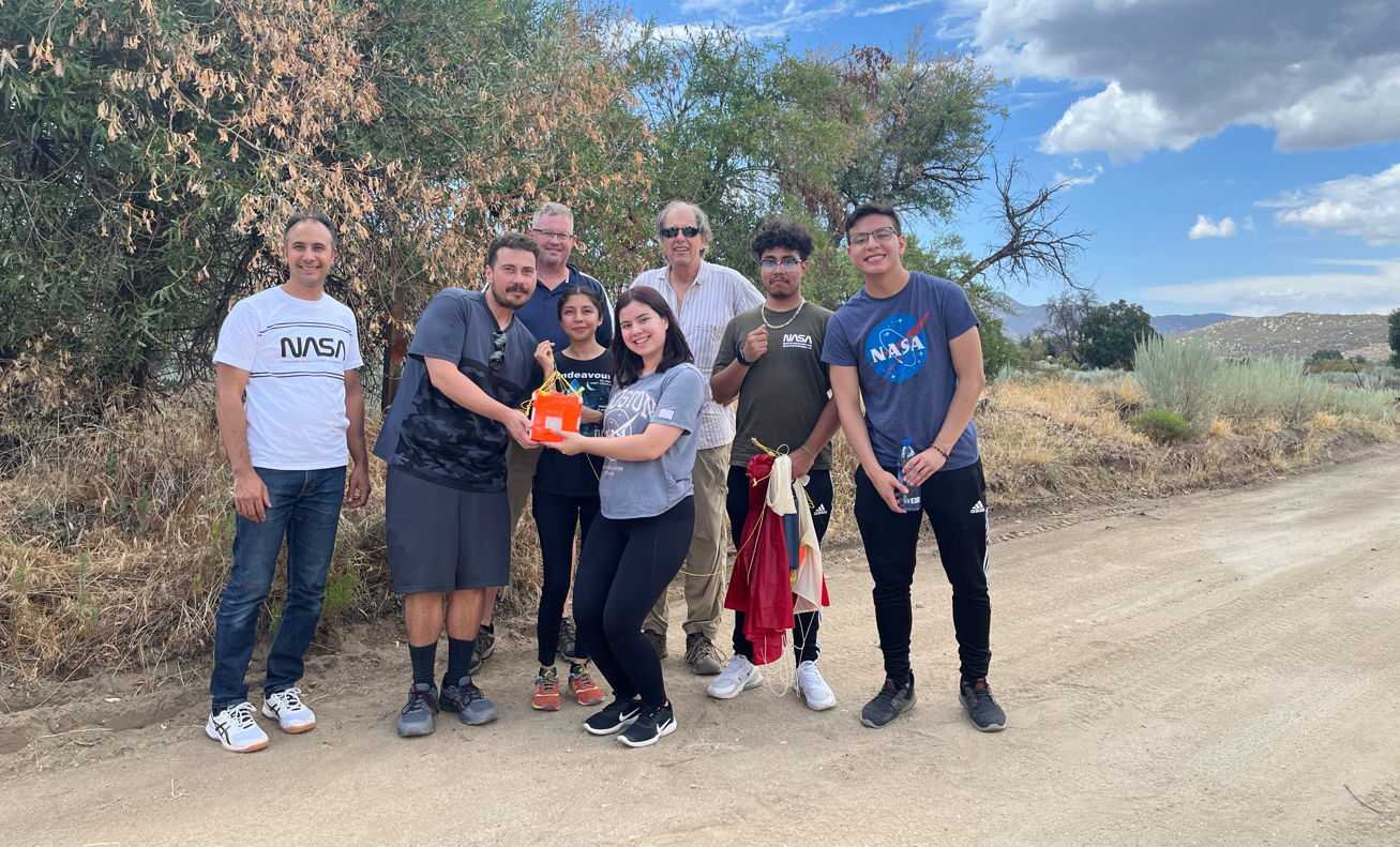
We tracked the satellite in real time to determine its location and landing area. We were fortunate in its landing location, as the terrain was reasonable in terms of the search. The above video shows the landing area as well. Once we retrieved the satellite, I backed up the data, and downloaded everything off of the satellite. I was overwhelmingly stunned from the images our satellite captured. We had flown so high as to be able to capture the curvature of the Earth. 103,000 feet into the stratosphere to be precise. 18 miles above the surface of the Earth. Seen below is the timelapse of the images captured by our satellite. In the lower corner of the video is a real time flight trajectory, showing the path that the cube satellite took as it flew over land. At the end of the video is where the curvature of Earth can be seen.
Overall, this project took several months to plan and complete. It involved developing a proposal for the ground station and satellite design, pitching that to my local college, developing a course for students to get involved, designing the satellite from start to finish, and then employing a summer internship for the students assemble the ground station, the satellite and plan for the day of launch. We were recognized by College of the Desert, NASA’s JPL administrators, namely Rosalind, and were invited to speak at JPL in the upcoming spring. We were also on the news and got to present at College of the Deserts status of the college of event. Seen below is my news interview about the project.
Since the validation of version 1 was a success, we are seeking funding for the version 2, which will ideally, be launched into space within a few years. We are seeking to collaborate with other local colleges, namely UCR. I would like to thank the College, my mentors Dr. Ahmed Elshafie, Pr. Mike Gariety, Pr. Frederic Raab, and Pr. Jorge Perez for pushing me to be the best I can be. Despite the 70-hour work weeks, and intensive stress from being the project lead, I feel accomplished and proud of the work we did. I would also like to thank my team members for their support and contribution. Without their hard work and dedication, this project could not have come to fruition. Thank you Grecia Siono, Enrique Siono, Paloma Rubio, Josue Garcia, and Yasuko Smith.
Leave a Reply